Need some wind therapy?

With 45+ years of riding experience, the team has developed a library of our favorite rides in Texas and points beyond. We call them our Twisted Rides. We thought it might be a good idea to share that experience and encourage you to do the same!

We partnered with MyRoute-app, a leading provider of route planning tools, to create and share the routes. Using the map below, Users are able to view and download the routes without registering with MyRoute-app. If you would like the ability to open/edit/save the routes, the User will be prompted to register with MyRoute-app and offered two subscription levels - Basic (free) and Gold (fee dependent on subscription term and payment method). Being an avid ride planner, I prefer the Gold level for the additional features and I also believe in supporting independent software developers who invest their time and talents to create useful applications for the motorcycle industry. As a Twisted Rides referral, you receive an extended evaluation period and special pricing if you choose the Gold level - so give it a shot!

What journey is on your bucket list? Click on a ride below and we'll show you the way!

Thursday, May 10, 2018

GST Day 3 - Del Rio to Big Bend - 252 miles

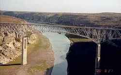
Departing Del Rio, we took US-90 across Lake Amisted. The views were nice, but we were blown away as we popped over the hill that led to the bridge across the Pecos River. It was too late to stop for a photo op, so I grabbed a couple of images off the Internet that says it all.


A little further down the road, we stopped in Langtry to see the Judge Roy Bean “Law West of the Pecos” museum and exhibit. Texas has some colorful characters in its history, and Judge Roy Bean has to be near the top of the list.


The towns in this part of Texas are few and far between...and many are little more than a post office and a few houses. So when we pulled into Marathon, my fuel light was glowing bright and the remaining miles showed “2”. Fuel burns fast 75-80 MPH. A gas station/grill was the first open commercial enterprise as we entered the “town” and it was the only operating fuel station within miles. TripAdvisor showed five dining options available, three of which were closed for lunch. So we settled on the Oasis Cafe, home of okay food and a really sassy waitress. While the town doesn’t look like much, it does have a restored, historic hotel named the Gage Hotel. Cool place and I’d like to stay there next time through.

Downtown Marathon - Looking West

Marathon - Oasis Cafe

Downtown Marathon - Looking East

Heading south out of Marathon is US-375, which leads into the east entrance of Big Bend National Park. The further south we went, the temps were heated up. Really heated up. Like to 102*. “It’s a dry heat” my a$$. On the road in, the desert cactus still held some of their bloom...just to welcome us, I’m certain.


When we got to the Panther Junction Visitors Center, we were ready for a hydration stop. My riding partner, Scott, purchased his annual pass and we learned that the Visitors Center was one of the few locations within the park with cellular coverage. So we made our check-in calls before heading to the Chisos Mountains Lodge for a cold adult beverage before heading to Terlingua for the night.

While at the lodge, we learned that Terlingua was experiencing a power outage with no determined resolution time...which apparently is not uncommon for the area. The thought of staying overnight in Terlingua with +90* temps in the evening was deemed not an option. Fortunately, the Lodge had a room available, so we unloaded, unpacked, and cleaned-up to enjoy happy hour and dinner setting amongst some great mountain views.

The pics say it all...


View from the Visitors Center

View from the Parking Lot

View from the Room Balcony

Sunset through the Mountains

Wednesday, May 9, 2018

GST Day 2 - Kerrville to Del Rio - 225 miles

We had a leisurely ride through some of the best roads in Texas - TX-16 south of Kerrville and the Three Twisted Sisters (RR-335, RR-336, and RR-337). For those of you not familiar with Texas’ naming practice for roads, ranch roads (RR) and farm-to-market roads (FM) are named to reflect that ranchers and farmers donated the land for the state to maintain paved roads that would make their respective agricultural endeavors more feasible. As a result, the roads follow the property boundary lines at the time, which results in some really cool sweeps and twisties. True American collaboration. These roads are my favorite...low traffic and lots of scenery.


Best Western Sunday House - Kerrville
A great stop on TX-16 is the Medina Highpoint Resort (formerly known as Koyote Ranch). The place was built as a RV resort and campground by a commercial real estate developer out of Dallas. During construction, he noticed a lot of motorcycles going down TX-16, so he added a bunch of cabins in hopes of capturing the bikers enjoying the Texas Hill Country. Long story short, he ended up losing the business in 2010 and I was two weeks too late in making an offer for the real estate out of receivership, with the intent of turning it into a motorcycle resort, similar to Iron Horse Motorcycle Lodge in Western North Carolina. You win some, you lose some. The place still has a cool grill/beergarten, and an outdoor entertainment venue. The pisser always gets a laugh...


Medina Highpoint Resort - TX-16


Beergarten


Pisser - Ice and Targets!
In Medina, we turned west on the bottom half of the first sister. Lots of curves and elevation changes. I love the waist down of a woman, and this sister does not disappoint. We had hoped to stop-in at the Lone Star Motorcycle Museum in Vanderpool, but he is only open Thur-Sun this time of year (today is Wed). We continued to Leakey (pronounced in these parts as “Lake-ee”) where we refueled and checked out the smoked meats, a tribute to the German settlers who settled the area. We rode the Three Twisted Sisters counter-clockwise, a first for me...and I now prefer that routing. Northbound RR-336 runs through a lot of free-range ranch land. So instead of having fencing along the side of the road, the cattle are free to roam all over (including on the road) and the ranches are separated by cattle guards across the road. Cattle guards are essentially pipe laid across the road that keeps the cattle from crossing the boundary (cattle only like walking on flat, stable ground). 
FM-336
The northern boundary of the Sisters is TX-41, then we turned South on RR-335, which parallels and cross-crosses the Nueces River. In many places, the road is cut into the side of the mountains (hills to those who live in mountainous areas) and it is a combination of twisties and a roller coaster ride. Motorcycle heaven. 

We ended up in Camp Wood, a small community on the SE corner of the Sisters that is part of the Edwards Plateau. Camp Wood was a military outpost in the 1800’s and has two other claims to fame. In 1924, Charles Lindeburgh and an assistant had to emergency land his plane in a nearby ranchers field due to low fuel. They partially refueled and attempted a take-off, but the field was too soft to handle the load. So they unloaded all the luggage and Lindeburg, and the assistant was able to land just south of town on a gravel road which was the major road to Uvalde in the day (now TX-55). They refueled again and attempted a take-off, only to clip a telephone pole and crashed into the town’s hardware store. It took a few weeks to get the repair part shipped-in and they were finally able to fly-out.


The second claim to fame is a little more macabre. Remember the most hated woman in America, Madalyn Murray O’Hair? Ms. O’Hair was an atheist and filed federal lawsuits to have school prayer removed from public schools. Yeah, well in 1995, she, her son, and her granddaughter were kidnapped and later murdered. Their dismembered bodies were found stuffed into 55-gallon barrels just south of Camp Wood...about a mile south of where we enjoyed BBQ today. Today, Camp Wood is a quiet, peaceful where people move to be forgotten.


Heading south on TX-55, we turned west on the Twisted Stepsister, RR-334. Not much exciting about this road except is passes by some of the largest ranches in Texas...we’re talking THOUSANDS of acres. If we had more time and a lot more $$, we would have stopped and driven some BIG military equipment at DriveTanks. The closer to the border we rode, the more U.S. Border Patrol presence we saw. We ended the day in Del Rio, a mere four miles from the US/Mexico border. 

We enjoyed happy hour by the pool and a fantastic authentic Mexican food dinner.

Tomorrow, lots of miles, two border patrol check points, and Big Bend National Park...

Tuesday, May 8, 2018

GST Day 1 - Tyler to Kerrville - 341 miles

Today was all about repositioning to the Texas Hill Country, so not much in the way of scenery or sights. Speed limits were 65+, but lots of small towns that slowed the pace somewhat. Spent most of our road time dodging roadkill. It was not a good night if you were a raccoon, possum, or a slow buzzard. Saw one dead coyote hanging from a fence post. The ranchers in Texas take no prisoners.

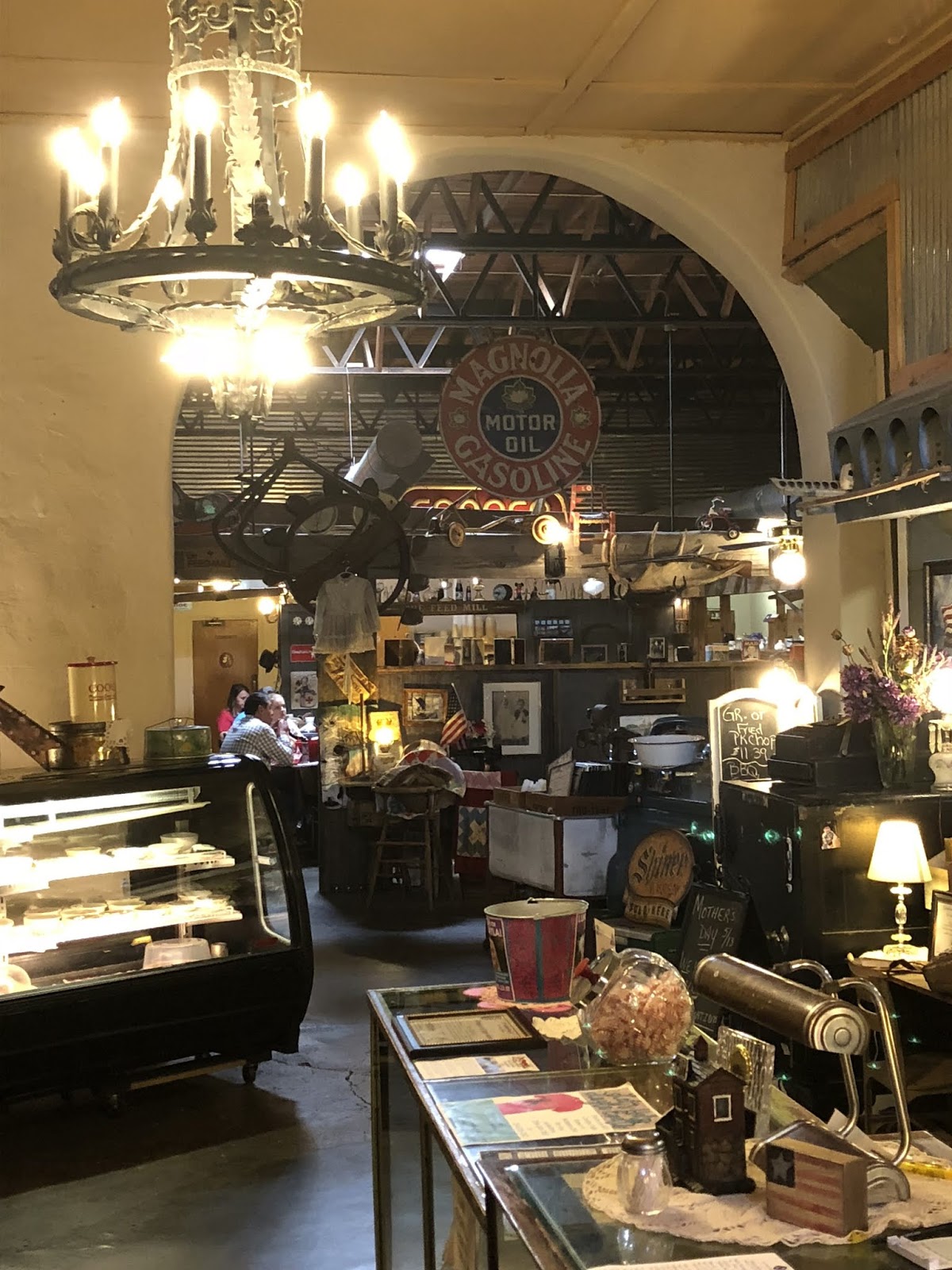
We stopped in Gatesville for lunch and discovered a cool little local place named The Feed Mill where I had one of the best burgers ever.


Feed Mill Restaurant, Gatesville, TX


We had a contingency stop in Luckenbach planned, but opted not to go due to the heat...92 and rising according to the Infotainment temp gauge. We’ve both been there plenty of times.

Instead, we arrived at the Best Western Sunday House in Kerrville and enjoyed happy hour poolside under the huge live oak trees.


Monday, May 7, 2018

Great Southwest Tour (GST) - Ride Map

The Great Southwest Tour (GST) is a cross-country adventure beginning in Tyler, Texas and riding through the southern states towards Phoenix, AZ. We opted to fly the spouses into PHX, hence the diversion. Otherwise, after running the Devil's Highway (US-191) South, we would have routed around PHX via the Tonto National Forest.

On the outbound, it was a hard push to the Texas Hill Country to enjoy the Three Twisted Sisters, Big Bend National Park, the mountains in New Mexico (weather permitting) and the White Sands Missile Range.

Once in Arizona, we toured the South and North Rims of the Grand Canyon, Antelope Canyon, Zion National Park, Bryce Canyon National Park, Capitol Reef National Park, Monument Valley, Los Alamos National Labs, and Santa Fe.

WARNINGS: Some legs of this route may not be open during the winter months. Route must be broken down to files with less than 60 waypoints to avoid freezing-up the H-D Boom! Box 6.5GT Infotainment System.


Friday, April 13, 2018

Texas Wildflower Trail - 2018

I've lived in several regions in Texas. But as an adult, I've always had a soft spot in my heart for the Texas Hill Country. There is just something about the semi-arid terrain, the wicked looking oak trees, the people, the music, the BBQ, and...the rolling, twisty roads.

So when wildflower season comes along, what better excuse is needed! Given a relatively wet fall, this was hyped to be a banner season in wildflower production. But the lack of spring rain seems to have put a damper on Mother Nature's plans. Nonetheless, it was worth a trip down to see what's going on in the Hills. This trip was also intended to serve as a warm-up to a planned Great Southwest Tour (17 days / 4,200 miles)  that will take place in early May.


Day 1

My bride and I departed on Tuesday, April 10, for a three day tour on what I call the Texas Wildflower Trail. On the way down, we took a late lunch break at Louie Mueller BBQ in Taylor. Much to our surprise, the meats were a little disappointing this time around. The brisket was fatty (despite asking for the lean portion) and the pulled pork was dry. Perhaps it was because we were at the tail-end of the lunch run. Perhaps it was just coincidence. Perhaps they just had an off day in the smoker. Perhaps we'll try another eatery next time through.

After lunch, we took the slab around Round Rock to avoid the in-town traffic. Once on the west side of town, we took FM-1431 out to Marble Falls which we used as a base camp for two nights. We covered 270 miles for the day and were ready for Happy Hour by the pool, followed by a burger and early bedtime.


Day 2

After breakfast, we departed the hotel in 50 degree temps which quickly rose to 70 degrees by Noon. To get the tires warm, we took FM-2147 around the southern edge of Lake LBJ, going by Horseshoe Bay and the many other resort communities that have been built to cater to the weekend and retired crowd. After a short jaunt on TX-71, we then took FM-962 (and several other county and FM roads) as a back road approach to our first destination, the Willow City Loop.

In the +20 years we've been coming to the Hill Country on the bike, we have driven by the Willow City Loop countless times, never taking the time to see what it had to offer. The loop is essentially a narrow road that meanders through perhaps 100's of ranchettes surrounding Willow City and provides spectacular views of flower-filled meadows and valleys on its 13-mile trek. The place is a "must see" especially in the Springtime.

There are no shoulders and all of the land is privately owned, so travelers are discouraged from pulling over and getting out. But it's impossible to resist the temptation, so we just parked on the road!


The northeast section of the loop has a pronounced elevation change, providing a view of a rustic "mountain" ridge and once at the top, a spectacular view of the valley below. We didn't have a decent place to stop once at the top, but did capture some pics of the ridge.


Once we completed our tour of the Willow City Loop, we headed north on TX-16 to Llano. We were tempted to stop at Coopers BBQ, but the line was too long, so we opted to continue on to Mason. Mason has a smaller Coopers BBQ venue, but also has a well-ranked down-home restaurant on the town square, called the Square Plate, that threw-down some tasty German vittles Texas-style.


Mason is a small ranching community that was originally founded as Fort Mason, a safe place for travelers while travelling through Apache and Comanche territory in the 1800's. The German heritage of the founders is evident in the architecture, churches, culture, and food...even today. It's not a big place, but the people are real friendly.


Of course, no trip to the Hill Country is complete without a stop in Luckenbach. We arrived late afternoon with the hootin' and hollarin' and singin' already underway. There were a half dozen bikes parked in the lot, along with a tour bus and several cars - probably a crowd of 50 or so. Not bad for a Wednesday afternoon in mid-April. The beer was flowing, the crowd was singin', and the roosters crowing. I sometimes wonder if those roosters aren't trained to crow at just the right time when the artist(s) is singing "Let's go to Luckenbach Texas".


After catching and releasing our beer, we headed back to the hotel for our own private Happy Hour. We took the back roads and FM-1320 east of Fredericksburg was wildflower heaven...but we didn't stop for pics!


Day 3 

Another Hill Country mainstay is the Blue Bonnet Cafe in Marble Falls. Since 1929, the Blue Bonnet Cafe has been the place to see your neighbor, catch up on what's happening around town, or just stop-in when you're passing through. Their breakfast is the best around...as are their pies any time of day! Suffices to say, THIS is were we started our day.

Pic provide view Blue Bonnet Cafe's website

Pic provide view Blue Bonnet Cafe's website

Hoping to see more wildflowers, we took a northern route home - heading up US-281 to Hamilton, then TX-22 through Meridian and across Lake Whitney and into Hillsboro where we enjoyed lunch at the quaint Cotton Exchange Restaurant. The service was a little slow, but the food worth the wait.

With a front moving down, we experienced 25-30 mph wind sustained gusts the entire journey home. Seriously, I bet the bike was leaning +10 degrees into the wind. And unfortunately, the wildflowers were even more sparse along the route. But how can one complain having spent three quality days with my bride and riding my motorcycle!

All-in-all, the trip was about 800 miles. The new Ohlin Blackline 772 suspension performed flawlessly, even when the bike was fully loaded, as did the new 18" Touring Shield from Freedom Shields. Yup, I think Dusty is ready for the Great Southwest Tour...after a bath, of course.

Monday, March 26, 2018

Spring has Sprung!

With the effects of global warming and all that makes up the unfortunate truth that is Al Gore, these United States are definitely experiencing very unusual weather patterns. Whether it's the threatening Spring rains in the West, the above average temperatures in the Southwest, or the Wizard-of-Oz-like storms in the Midwest and Northeast, it's been a little tough for us bikers to put some rubber on the road lately.

So when I found a window of opportunity, I went through it.

I wanted to tour on some of the less traveled roads of East Texas - something that included a tree-lined winding road, scenic views, and, oh, and a lake breeze along the way would be nice too. I had the perfect combination of roads in mind, just hadn't put them all together into a single ride before. No problem. After a little route planning, I figured I could do the ride in a little over three hours.


After fueling up the bike, we used FM-2607 to warm-up the tires with gentle rolling sweeps that continued as as we made our way north to FM-850 and eventually FM-757. By the time we hit US-271, the bikes were ready to cruise at highway speed and we did until we entered the quaint community of Gladewater. Gladewater was founded in the 1870's as a lumber town and by the 1930's, the large East Texas Oil Field had been discovered. The town diversified into a two-industry town (lumber and oil), growing to just over 6,000 residents. In 1935, it became the home of a Boston Red Sox minor league franchise, the Gladewater Bears. But like most boom towns, the community declined when the boom went to bust and now it's known more for it's antique stores and agriculture business. 

After continuing north on US-271, we turned east on FM-726 to begin the trip back in time. FM-726 twists and turns through the loblolly pine forests and horse ranches that spot the landscape between Glenwood and Graceton. By the time we cross US-259, we're into a rhythm of left and right sweeps over and around gently rolling hills. The population is fairly sparse in this part of Texas, leaving the road mostly to adventurous bikers on this Saturday morning. We crossed FM-1972 and FM-1968 along the way, both of which are excellent side roads in and of themselves, but we'll save them for another day.

This area of Texas is known as the Piney Woods and the crown jewel is Lake O' the Pines. Lake O' the Pines was opened in 1959 when the Army Corps of Engineers completed construction of a 10,600 foot long dam on the Big Cypress Bayou. FM-726 runs across the concrete and earthen dam, providing a breathtaking view of the lake to the north and the resulting spillway rapids to the south. Although we were at the southern end of the lake, the breeze coming across the water provided a nice cool-down effect as we enjoyed the views. 

Below the dam, the Big Cypress Bayou continues through Jefferson - the most haunted town in Texas - and feeds Caddo Lake, eventually merging into the Red River. Jefferson was founded in 1841 and was a key inland port with access to St. Louis and New Orleans via the Red River and the Mississippi River. The access was made possible because of a massive log jam on the lower Red River (near Natchitoches, LA) which raised the water level in Caddo Lake and the Big Cypress Bayou. Through the 1800's, there were numerous attempts to remove the log jam and all failed until the Army Corps of Engineers used nitroglycerin to blow it up in 1873 in an effort to control flooding upstream. Once the jam was removed, the water levels receded and Jefferson was left high and dry, as least as it relates to commercial boat access. Today, Jefferson is mostly known for it's quaint Bed and Breakfast lodging in majestic Victorian homes of yesterday, awesome antique shopping, and the evening haunted walking tours of the town.

We turned north on FM-729 which parallels the east side of Lake O' the Pines. After a short water break in Avinger, we hit the tight twisties on the north end of FM-729 with a little extra speed, just to add some thrill. There is something about opening it up as you run through the tree canopies that just reinvigorates the soul. 

For the return route, we took TX-155 through Gilmer, then headed west, hitting FM-49, FM-1002, and FM-1795 to Hawkins. We turned south on FM-14 and then FM-2015 for a more direct routing back home. 

It was a beautiful day for a ride...and a beautiful ride.

© 2018 Twisted Road Motorcycle Company, LLC

Friday, August 25, 2017

FILR Mancation 2017

A buddy of mine and I are going through career changes and decided it was a good time to hit the road. We named the ride the Fvck It, Let's Ride (FILR) Mancation 2017 and thought we'd head for the mountains of West Virginia in hopes of escaping the heat that is pounding the South. The dates of the ride were August 14-22. With Scott based in Charlotte and me in East Texas, we chose Chattanooga, TN as the start/end of the tour.

Altogether, I spent 1,696 miles in the saddle and 1,450 miles in the seat. I trailered to/from Chattanooga to avoid heavy thunderstorms on the outbound leg and extreme heat on the return (+100 degrees with the heat index). The route file below is the saddle portion of the adventure.


Day 1
Travel to Chattanooga.


Day 2
With 271 miles planned for the day, Scott and I were both eager to hit the road early. Living in different parts of the country, it's been a while since we toured together on a long-distance ride. I had never been through eastern KY or WV, but had heard of - and read about - many of the sights we were going to see along the way. Our first scenic stop was Cumberland Falls. The falls are not as tall as some I have visited, but it is wide and powerful...and muddy. We tried to rent barrels so that we could ride the falls, but the nice park ranger advised against the idea. The heat was rising after the falls, so we stopped by The Root Beer Stand in Corbin, KY for a root beer float. I highly recommend!

Cumberland Falls


Day 3
Having stayed at the Cliffview Resort in Zoe, KY, our Day 3 ride began with a beautiful run through the Natural Bridge State Park along KY-11, then along KY-77, also known as the Nada Tunnel Road. When I shared how beautiful the Nada Tunnel Road was with a friend from KY, she informed me that her husband's great grandfather helped cut the tunnel so that he could haul timber from his land on the east side of the mountain range. Small world.

Pic from the Internet, but is the view exactly as soon from over the handlebars.


Our first fuel stop of the day included an interesting encounter with the locals. There were four ladies in two cars that were at the service station when we arrived. Appears they were on a journey and had stopped for a drink and smoke break. As they prepared to leave, all four were wearing those u-shaped travel pillows around their necks. It was definitely a WTFWT moment and we were laughing too hard to sneak a pic. Guess these are called Kentucky Airbags around these parts.

There were storms forming on the horizon, but we placed a bet that we thought we could skirt them. Unfortunately, the mountains and twisty roads proved us wrong and we got drenched in the early afternoon...before we had a chance to don the rain gear. It was a welcomed relief from the heat, but made the twisties that much more treacherous.

We survived and were mostly dry by the time we pulled into the Mardi Gras Resort and Casino in Nitro, WV just north of Charleston. The Mardi Gras is very biker friendly and has a pole shed for parking the bikes. The shed is well lit and has security cameras. Nice Touch! Beer not included.

Motorsickle parking at the Mardi Gras Resort and Casino


We enjoyed dinner while watching the greyhound races, then made a few donations in the casino before retiring for the night.

Day 4
With storms off to the east, we headed south on WV-85, then on WV-10. Both roads cut through coal country and followed a river or two along the way. While stopped at a McDonald's in Matoaka, WV for a break, we struck-up a conversation with an 80 year-old gentleman who had lived in Matoaka all his life. Although he had very little formal education, he was a self-taught and successful Ford mechanic, electrician, home builder, and coal miner. I suspect there was very little this man can't or hasn't fixed at some point in his life. A former Harley-Davidson rider (as well as many other brands), he still mows his own lawn (and those of his rent houses) using a push mower and is pretty handy with his smartphone too! I walked away thinking he was one of the happiest and most accomplished men I have ever met. I love the conversations with the people along the way, it always makes a motorcycle trip special.

We closed the day with WV-16, also known as the Back of the Dragon. IMO, the many twisties, coupled with the major elevation changes, makes this a more technically challenging ride than the Tail of the Dragon...and it was a LOT less crowded.We ended the day at the General Francis Marion Hotel in Marion, WV. Marion is a small town with a cool little downtown and a half-dozen restaurants within walking distance.

No pics today...too busy riding!


Day 5
Leaving Marion, we followed Black Lick Road through the farms and forests. The views reminded me of what it must be like riding through the rolling hills of Ireland - bright green fields, gentle rolling hills, and undulating twisties. Add to it the smells of the many farms along the way and it really sets the mood for riding that morning. Once we turned north on US-52, we immediately entered one of the fingers of the George Washington and Jefferson National Forest. This area played a key role in the Civil War. We stopped at the Big Walker Lookout to catch a view of the valley below and to read-up on the path the Union troops took to capture the railroads and cities along the way.


Just outside of Hillsdale, WV, we stopped at the John Henry Historical Park to see Mr. Henry's legacy. From the museum's website:

The legend of John Henry depicts an American folk hero known for his amazing strength and symbolism as an advocate for the working class American during the industrializat of not only Appalachia, but the entire United States. During the late 1800's, the railroad embarked on its expansion plans to head West over the Appalachian Mountains. John Henry, along with crews of men made up of over 1,000 former slaves and Irish immigrants, was hired to tunnel through the mountain, using hammer and steel rods to cut through the rock. Eventually the railroad management, in its quest for efficiency and speed, brought in the Burleigh;s top of the line steam powered drill to replace the crews on men. As the legend goes, John Henry challenged the railroad to a contest pitting his skill and strength using hammer and steel rods against the machine to prove the superiority of manual labor to mechanization and to, hopefully, preserve their jobs. John Henry made more progress in a shorter period of time than the machine, however, as the legend goes, he later died as a result of the contest.

The battle did not end with John Henry's death. As a result of his heroic victor over the machine, the crew of over 1,000 men kept their jobs and finished the tunnel. John Henry's legend served as an inspiration to those men finishing the tunnel as they kept the story alive through song. Although the "legend" has been embellished over the years, the reality is John Henry was a real man, hero, and symbol of hope. His legend lives on.

Our pinnacle destination of the day was the Bunker Tour at The Greenbrier in White Sulphur Springs, WV. From 1962-92, this top secret bunker served as an emergency back-up site for members of Congress in the event of a nuclear attack. Built at the peak of the Cold War, the bare basics bunker was "hidden in plain sight" from the many guests who frequented the luxurious Greenbrier Resort. it included a state-of-the-art communications system and enough food, water, and fuel storage to be self-sufficient for up to 45-days. This is a must-see if you are ever in the area.


Day 6
We were met with a wonderful surprise leaving Lewisburg, WV...US-219. On the map, it appeared to be a rather straight run through the valley, but we were pleasantly surprised to find beautiful scenery, a decent amount of elevation changes, and a number of welcomed twisties. North of Marlinton, we maneuvered more technically challenging twisties as we climbed to the highlands, then turned on WV-150 (also known as Highland Scenic Highway) for a long, gentle run along the ridge of the mountain. WV-150 connects to WV-39 around the Cranberry Glades Botanical Area and we followed the road west through the mountains and into Summerville, WV. We explored Summerville Lake which feeds the Gauley and New River recreational areas (camping, hiking, rafting, etc.) before continuing on to Charleston and the Mardi Gras Resort and Casino for a nice meal and an attempt to recover from our previous losses. Good thing we ate before gambling.


Day 7
Feeling a little road fatigue, we opted for a more direct route down to Bristol, VA than we originally planned so that we would have time to explore downtown Bristol before they rolled the sidewalks up on Sunday. We stopped by the Indian Motorcycle dealer for a quick look see and stumbled across this beauty, a 2017 Jack Daniels Limited Edition Chieftan. It was already sold and under-cover, but we were able to get a sneak peak.


This was our last day of touring together, as Scott was peeling-off towards Charlotte in the morning. We decided to celebrate the tour by pigging-out at Cootie Brown's in Bristol. Their Memphis-style baby back ribs are to die for!


Day 8
The day of the 2017 North American Solar Eclipse!!

I originally planned to witness the eclipse on Clingman's Dome in the Great Smoky Mountain National Park, but news reports of large crowds and traffic problems steered me to Plan B, a spot along US-411 just a little south of Madisonville, TN, which just happened to be dead center in the path of totality. Traffic was relatively heavy along the way, but most folks were stopping in Maryville or Vonore to set-up their viewing spots. The opportunistic entrepreneurs were out in full force, charging between $10-$20 for a parking spot along the road. There were license plates from all over the South and Mid-Atlantic, even a few from Canada. Kudos to the City of Madisonville, where they opened the city park for free parking, as did many churches.

I found my perfect spot, donned my ISO 12312-2 approved geek glasses, and set-up my smartphone to capture the historic event. My location was very remote, only 2-3 other people within sight in any direction. As the eclipse reached its totality, all highway traffic came to a halt, it became eerily quiet, and everything went totally dark. At the farm across the highway, the roosters began to crow and a flock of birds were swarming out of confusion. Two minutes later, the light began to return and life returned to normal. Sadly, the iPhone pic doesn't do the experience justice.


I spent the rest of the afternoon fighting traffic back to Chattanooga.


EPILOGUE
One of the most intriguing things I noticed on the ride were the geometric or hex designs mounted on the barns in the area. I researched this phenomena and founds the designs began with the Pennsylvania Dutch. They are usually 8'x8' and are placed on the barns for good luck in crop production or fertility of the livestock. I hope they produce the intended results, but nonetheless, they are beautiful and certainly added to the quaint rural scene.

While I really enjoyed this tour, I continue to learn the art of touring. I felt as though I had a little beginner's relapse reflected in my planning. Simply stated, I made the daily rides too long, ranging from 190-270 miles on the back roads, which translated to 6-7 hours in the saddle. This limits the amount of time one can spend on really seeing the sights and meeting people along the way - the very things that make such a ride so special. It also cramped our ability to find those mom and pop cafes where you literally get the flavor of the area. And pics...NOT ENOUGH PICS!!

But I do have the memories.