Well, the route planner giveth and the route planner taketh away...
Our first stop was the Fort Davis National Historic Site, one of the most preserved forts in the South. Fort Davis was established to provide safe passage for travelers headed west, seeking riches from the California Gold Rush. Seems the Comanche and Apache indians didn’t take too kindly to the newcomers, so extra protection was required. Much of the site has been preserved, though many ruins remain which provide a true sense of the size of the facility. The fort was staffed primarily by the Buffalo Soldiers from the Eighth Infantry, the first all-Negro regiment in the Army. Very interesting for those who enjoy military and frontier history.
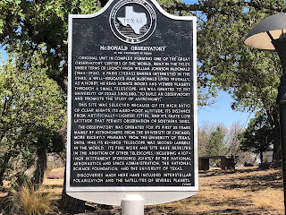
Next stop was McDonald Observatory. We took the self-guided tour through the Visitors Center, then wondered up to two of the three buildings which house the telescopes. Hard to imagine that the original scope was installed in 1939 and some components are still in use today.
We continued on the Texas Mountain Trail, working our way to Van Horn, where we hoped to enjoy lunch at the historic El Capitan Hotel. Much to our chagrin, the restaurant only serves dinner, so we dined at the second best place in town, Chueys Mexican Restaurant, which has been frequented by the likes of John Madden on his many cross country tours covering football.
From there, we went through Dell City, hoping to take the quick road to Alamogordo. I had received several notices about unpaved roads on my route and we found it right at the Texas/New Mexico border. Turns out the Infotainment GPS was smarter than the route planner. Rather than ride 100+ miles of dirt road, we back-tracked and re-routed through El Paso, which added about 90 minutes to our planned ride, but did give us an up-close perspective of the massive size of Fort Bliss. It also gave me another opportunity to test the range of the fuel supply. Looks to me like I had another 20-30 miles available, but better safe than stranded.
Need some wind therapy?
With 45+ years of riding experience, the team has developed a library of our favorite rides in Texas and points beyond. We call them our Twisted Rides. We thought it might be a good idea to share that experience and encourage you to do the same!
We partnered with MyRoute-app, a leading provider of route planning tools, to create and share the routes. Using the map below, Users are able to view and download the routes without registering with MyRoute-app. If you would like the ability to open/edit/save the routes, the User will be prompted to register with MyRoute-app and offered two subscription levels - Basic (free) and Gold (fee dependent on subscription term and payment method). Being an avid ride planner, I prefer the Gold level for the additional features and I also believe in supporting independent software developers who invest their time and talents to create useful applications for the motorcycle industry. As a Twisted Rides referral, you receive an extended evaluation period and special pricing if you choose the Gold level - so give it a shot!
What journey is on your bucket list? Click on a ride below and we'll show you the way!


No comments:
Post a Comment