Need some wind therapy?

With 45+ years of riding experience, the team has developed a library of our favorite rides in Texas and points beyond. We call them our Twisted Rides. We thought it might be a good idea to share that experience and encourage you to do the same!

We partnered with MyRoute-app, a leading provider of route planning tools, to create and share the routes. Using the map below, Users are able to view and download the routes without registering with MyRoute-app. If you would like the ability to open/edit/save the routes, the User will be prompted to register with MyRoute-app and offered two subscription levels - Basic (free) and Gold (fee dependent on subscription term and payment method). Being an avid ride planner, I prefer the Gold level for the additional features and I also believe in supporting independent software developers who invest their time and talents to create useful applications for the motorcycle industry. As a Twisted Rides referral, you receive an extended evaluation period and special pricing if you choose the Gold level - so give it a shot!

What journey is on your bucket list? Click on a ride below and we'll show you the way!

Sunday, May 13, 2018

GST Day 6 - Alamogordo to Alpine, AZ - 299 miles

We expected today to be little more than a repositioning day into Arizona. We were pleasantly surprised.

US-54 out of Alamogordo is a pretty boring, straight four-lane road, but things began to get interesting as we turned west on US-380 in Carrizozo, NM. About four miles out of town, we came upon the Valley of the Fires Recreational Area. Valley of the Fires appears to be a large burned-out area, where the rocks looked scorched from black smoke. In actuality, it is several square miles of buckled and twisted basalt lava that is more than 160 feet deep and over 45 miles long. It was formed when several volcanoes in the area erupted and the flows joined.

Pic Source: Internet

As we continued across US-380, we abutted the northern boundary of the White Sands Missle Range, complete with signs indicating the road is sometimes closed during middle testing. We didn’t see any, but enjoyed the desert scenery.

In Socorro, we turned west again on US-60 and passed through Magdalena. About half-way to Datil, we saw what appeared to be many, many huge satellite dished on both sides of the highway. As we closed-in, we saw signs indicating it was a National Radio Astronomy Observatory facility. This particular facility houses the Very Large Array (VLA), which has been used to find black holes in space. VLA = Very Cool. I now wish we’d stopped to tour the small museum onsite. Oh, it’s also the location where the movie Contact was filmed.

Pic Source: Internet

Pic Source: Internet

Pic Source: Internet

Pic Source: Internet

In Datil, we turned South and eventually west on NM-12, riding through the mountains in the Gila National Forest - a beautiful road chocked full of twisties and elevation changes. Sadly, a large portion of the forest, as well as the area around Alpine, were burned in the Wallow Fire (2011) which was started by a campfire. The two men responsible were fined $3.7 million. If you’re going to play with fire...


In Alpine, we checked into the Sportsman’s Lodge, a quaint mom and pop motel run by a nice couple (Phyllis and Frank) who are also motorcycle riders. After checking-in, Phyllis brought us a little brasket with motorcycle cleaning supplies and micro fiber towels. Nice touch! The porch is complete with comfortable chairs and the view overlooks a large open meadow that usually have elk grazing in the evenings, though none appeared today.


During happy hour, we met Spencer, a BMW adventure biker who was also staying at the motel. He ended up joining us for dinner at the Alpine Grill and Still. He is from Santa Fe and rides AZ, UT, and NM extensively. He gave us some great ideas for enhancing the route around Phoenix and Flagstaff. Thank you, Spencer!

Bar at Alpine Grill

Protect the One-Eyed King Size Pecker

Bonus of the day: the temps stayed below 75* the whole way!

Tomorrow we ride the Devil’s Highway (US-191) and pick-up the wimmins in Phoenix in the evening. They will join us for the rest of the ride.

Saturday, May 12, 2018

GST Day 5 - Alpine, TX to Alamogordo, NM - 385 miles

Well, the route planner giveth and the route planner taketh away...

Our first stop was the Fort Davis National Historic Site, one of the most preserved forts in the South. Fort Davis was established to provide safe passage for travelers headed west, seeking riches from the California Gold Rush. Seems the Comanche and Apache indians didn’t take too kindly to the newcomers, so extra protection was required. Much of the site has been preserved, though many ruins remain which provide a true sense of the size of the facility. The fort was staffed primarily by the Buffalo Soldiers from the Eighth Infantry, the first all-Negro regiment in the Army. Very interesting for those who enjoy military and frontier history.


Next stop was McDonald Observatory. We took the self-guided tour through the Visitors Center, then wondered up to two of the three buildings which house the telescopes. Hard to imagine that the original scope was installed in 1939 and some components are still in use today.


We continued on the Texas Mountain Trail, working our way to Van Horn, where we hoped to enjoy lunch at the historic El Capitan Hotel. Much to our chagrin, the restaurant only serves dinner, so we dined at the second best place in town, Chueys Mexican Restaurant, which has been frequented by the likes of John Madden on his many cross country tours covering football.


From there, we went through Dell City, hoping to take the quick road to Alamogordo. I had received several notices about unpaved roads on my route and we found it right at the Texas/New Mexico border. Turns out the Infotainment GPS was smarter than the route planner. Rather than ride 100+ miles of dirt road, we back-tracked and re-routed through El Paso, which added about 90 minutes to our planned ride, but did give us an up-close perspective of the massive size of Fort Bliss. It also gave me another opportunity to test the range of the fuel supply. Looks to me like I had another 20-30 miles available, but better safe than stranded.


Friday, May 11, 2018

GST Day 4 - Big Bend N.P. to Alpine - 240 miles

In doing route planning, I try to know as much as possible about a road before I take it. Usually it works out as planned. Sometimes it goes wrong for some reason, e.g., construction. And sometimes it just knocks your socks off. That. That last one was today.

Knowing fuel stations are scarce in the Big Bend area, we started the day with a fuel-up near the Panther Creek Visitors Center. With fuel in the tank and extra water in the tourpak, we headed off for the Santa Elena Canyon at the base of the park. The canyon guides the Rio Grande river through this section. Unless you are on an adventure bike, it’s a one road in/out access, 30 miles each way...with a speed limit ranging from 35-45 mph. Sounds a little painful, but the scenery is outstanding along the way and at the end. The huge cliffs in the pics below are on the Mexican side of the canyon. Perhaps this is where President Trump got the idea for the wall.


We said our goodbyes to Big Bend National Park via the west exit, which is just three miles from Terlingua. In Terlingua, we turned west on FM-170, which is informally known as the “River Road” and is part of the Texas Mountain Trail. The road runs through the Big Bend Ranch State Park to Presidio and points beyond. Once we passed through Lajitas, the road just went wild - canyon runs along the Rio Grande, twisties, more twisties, roller coaster rides over the small hills, and serious elevation climbs (to go over the mountains) where Closed Canyon narrows the river substantially, making it impossible to fit the road along the river. I thought I had been on all the best roads in Texas, but this one is my new favorite. A 50 mile adrenaline rush, for sure. It’s over 675 miles from my hometown, but I will be back...and I will bring friends.


Thinking back over the last two days of riding in the Texas desert, I have a new appreciation for the different desert scapes that we have been blessed to see. Get out and ride!

Thursday, May 10, 2018

GST Day 3 - Del Rio to Big Bend - 252 miles

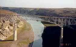
Departing Del Rio, we took US-90 across Lake Amisted. The views were nice, but we were blown away as we popped over the hill that led to the bridge across the Pecos River. It was too late to stop for a photo op, so I grabbed a couple of images off the Internet that says it all.


A little further down the road, we stopped in Langtry to see the Judge Roy Bean “Law West of the Pecos” museum and exhibit. Texas has some colorful characters in its history, and Judge Roy Bean has to be near the top of the list.


The towns in this part of Texas are few and far between...and many are little more than a post office and a few houses. So when we pulled into Marathon, my fuel light was glowing bright and the remaining miles showed “2”. Fuel burns fast 75-80 MPH. A gas station/grill was the first open commercial enterprise as we entered the “town” and it was the only operating fuel station within miles. TripAdvisor showed five dining options available, three of which were closed for lunch. So we settled on the Oasis Cafe, home of okay food and a really sassy waitress. While the town doesn’t look like much, it does have a restored, historic hotel named the Gage Hotel. Cool place and I’d like to stay there next time through.

Downtown Marathon - Looking West

Marathon - Oasis Cafe

Downtown Marathon - Looking East

Heading south out of Marathon is US-375, which leads into the east entrance of Big Bend National Park. The further south we went, the temps were heated up. Really heated up. Like to 102*. “It’s a dry heat” my a$$. On the road in, the desert cactus still held some of their bloom...just to welcome us, I’m certain.


When we got to the Panther Junction Visitors Center, we were ready for a hydration stop. My riding partner, Scott, purchased his annual pass and we learned that the Visitors Center was one of the few locations within the park with cellular coverage. So we made our check-in calls before heading to the Chisos Mountains Lodge for a cold adult beverage before heading to Terlingua for the night.

While at the lodge, we learned that Terlingua was experiencing a power outage with no determined resolution time...which apparently is not uncommon for the area. The thought of staying overnight in Terlingua with +90* temps in the evening was deemed not an option. Fortunately, the Lodge had a room available, so we unloaded, unpacked, and cleaned-up to enjoy happy hour and dinner setting amongst some great mountain views.

The pics say it all...


View from the Visitors Center

View from the Parking Lot

View from the Room Balcony

Sunset through the Mountains

Wednesday, May 9, 2018

GST Day 2 - Kerrville to Del Rio - 225 miles

We had a leisurely ride through some of the best roads in Texas - TX-16 south of Kerrville and the Three Twisted Sisters (RR-335, RR-336, and RR-337). For those of you not familiar with Texas’ naming practice for roads, ranch roads (RR) and farm-to-market roads (FM) are named to reflect that ranchers and farmers donated the land for the state to maintain paved roads that would make their respective agricultural endeavors more feasible. As a result, the roads follow the property boundary lines at the time, which results in some really cool sweeps and twisties. True American collaboration. These roads are my favorite...low traffic and lots of scenery.


Best Western Sunday House - Kerrville
A great stop on TX-16 is the Medina Highpoint Resort (formerly known as Koyote Ranch). The place was built as a RV resort and campground by a commercial real estate developer out of Dallas. During construction, he noticed a lot of motorcycles going down TX-16, so he added a bunch of cabins in hopes of capturing the bikers enjoying the Texas Hill Country. Long story short, he ended up losing the business in 2010 and I was two weeks too late in making an offer for the real estate out of receivership, with the intent of turning it into a motorcycle resort, similar to Iron Horse Motorcycle Lodge in Western North Carolina. You win some, you lose some. The place still has a cool grill/beergarten, and an outdoor entertainment venue. The pisser always gets a laugh...


Medina Highpoint Resort - TX-16


Beergarten


Pisser - Ice and Targets!
In Medina, we turned west on the bottom half of the first sister. Lots of curves and elevation changes. I love the waist down of a woman, and this sister does not disappoint. We had hoped to stop-in at the Lone Star Motorcycle Museum in Vanderpool, but he is only open Thur-Sun this time of year (today is Wed). We continued to Leakey (pronounced in these parts as “Lake-ee”) where we refueled and checked out the smoked meats, a tribute to the German settlers who settled the area. We rode the Three Twisted Sisters counter-clockwise, a first for me...and I now prefer that routing. Northbound RR-336 runs through a lot of free-range ranch land. So instead of having fencing along the side of the road, the cattle are free to roam all over (including on the road) and the ranches are separated by cattle guards across the road. Cattle guards are essentially pipe laid across the road that keeps the cattle from crossing the boundary (cattle only like walking on flat, stable ground). 
FM-336
The northern boundary of the Sisters is TX-41, then we turned South on RR-335, which parallels and cross-crosses the Nueces River. In many places, the road is cut into the side of the mountains (hills to those who live in mountainous areas) and it is a combination of twisties and a roller coaster ride. Motorcycle heaven. 

We ended up in Camp Wood, a small community on the SE corner of the Sisters that is part of the Edwards Plateau. Camp Wood was a military outpost in the 1800’s and has two other claims to fame. In 1924, Charles Lindeburgh and an assistant had to emergency land his plane in a nearby ranchers field due to low fuel. They partially refueled and attempted a take-off, but the field was too soft to handle the load. So they unloaded all the luggage and Lindeburg, and the assistant was able to land just south of town on a gravel road which was the major road to Uvalde in the day (now TX-55). They refueled again and attempted a take-off, only to clip a telephone pole and crashed into the town’s hardware store. It took a few weeks to get the repair part shipped-in and they were finally able to fly-out.


The second claim to fame is a little more macabre. Remember the most hated woman in America, Madalyn Murray O’Hair? Ms. O’Hair was an atheist and filed federal lawsuits to have school prayer removed from public schools. Yeah, well in 1995, she, her son, and her granddaughter were kidnapped and later murdered. Their dismembered bodies were found stuffed into 55-gallon barrels just south of Camp Wood...about a mile south of where we enjoyed BBQ today. Today, Camp Wood is a quiet, peaceful where people move to be forgotten.


Heading south on TX-55, we turned west on the Twisted Stepsister, RR-334. Not much exciting about this road except is passes by some of the largest ranches in Texas...we’re talking THOUSANDS of acres. If we had more time and a lot more $$, we would have stopped and driven some BIG military equipment at DriveTanks. The closer to the border we rode, the more U.S. Border Patrol presence we saw. We ended the day in Del Rio, a mere four miles from the US/Mexico border. 

We enjoyed happy hour by the pool and a fantastic authentic Mexican food dinner.

Tomorrow, lots of miles, two border patrol check points, and Big Bend National Park...

Tuesday, May 8, 2018

GST Day 1 - Tyler to Kerrville - 341 miles

Today was all about repositioning to the Texas Hill Country, so not much in the way of scenery or sights. Speed limits were 65+, but lots of small towns that slowed the pace somewhat. Spent most of our road time dodging roadkill. It was not a good night if you were a raccoon, possum, or a slow buzzard. Saw one dead coyote hanging from a fence post. The ranchers in Texas take no prisoners.

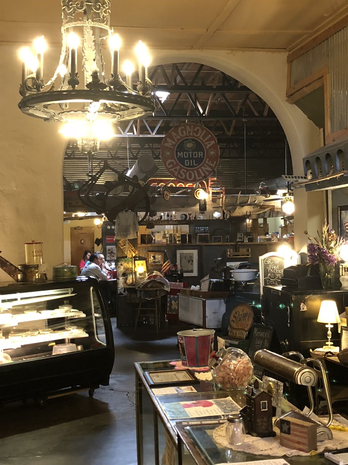
We stopped in Gatesville for lunch and discovered a cool little local place named The Feed Mill where I had one of the best burgers ever.


Feed Mill Restaurant, Gatesville, TX


We had a contingency stop in Luckenbach planned, but opted not to go due to the heat...92 and rising according to the Infotainment temp gauge. We’ve both been there plenty of times.

Instead, we arrived at the Best Western Sunday House in Kerrville and enjoyed happy hour poolside under the huge live oak trees.


Monday, May 7, 2018

Great Southwest Tour (GST) - Ride Map

The Great Southwest Tour (GST) is a cross-country adventure beginning in Tyler, Texas and riding through the southern states towards Phoenix, AZ. We opted to fly the spouses into PHX, hence the diversion. Otherwise, after running the Devil's Highway (US-191) South, we would have routed around PHX via the Tonto National Forest.

On the outbound, it was a hard push to the Texas Hill Country to enjoy the Three Twisted Sisters, Big Bend National Park, the mountains in New Mexico (weather permitting) and the White Sands Missile Range.

Once in Arizona, we toured the South and North Rims of the Grand Canyon, Antelope Canyon, Zion National Park, Bryce Canyon National Park, Capitol Reef National Park, Monument Valley, Los Alamos National Labs, and Santa Fe.

WARNINGS: Some legs of this route may not be open during the winter months. Route must be broken down to files with less than 60 waypoints to avoid freezing-up the H-D Boom! Box 6.5GT Infotainment System.